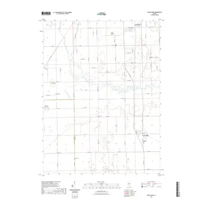
2021 Map of South Pekin
USGS Topo · Published 2021About this map
The Mackinaw River meanders across this Central Illinois landscape, creating a complex drainage network that includes Breedlove Ditch and Meeker Ditch. Significant local elevation changes are marked by distinctive features such as The Mound, Little Mound, and Hickory Grove Hill, which rise above the surrounding agricultural fields. The settlement of South Pekin anchors the northern portion of the sheet near the Pekin Municipal Airport, while Green Valley sits further south.
Find a feature on this map
72 named features on this map. Tap any name to fly to it.
Don’t see what you’re looking for? This feature index may not catch every label — zoom into the map to look around manually.
Map Details
Editions of this 2021 South Pekin Map
This is the sole edition of this map. No revisions or reprints were ever made.
Other maps of this area

1905 · Peoria
USGS Topo · 1:62,500

1927 · Peoria
USGS Topo · 1:62,500

1929 · Manito
USGS Topo · 1:62,500

1930 · Glasford
USGS Topo · 1:62,500

1932 · Manito
USGS Topo · 1:62,500

1942 · Delavan
USGS Topo · 1:62,500

1948 · Glasford
USGS Topo · 1:62,500

1958 · Peoria
USGS Topo · 1:250,000

1960 · Marquette Heights
USGS Topo · 1:24,000

1960 · Pekin
USGS Topo · 1:24,000