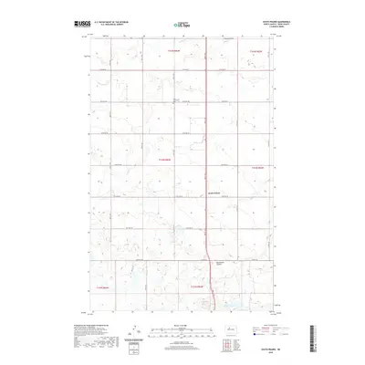
2020 Map of South Prairie
USGS Topo · Published 2020About this map
South Prairie stands as a focal point in this Ward County landscape, where the prairie is defined by a grid of agricultural section lines and township boundaries like t153n r83w. The map reflects a meticulously planned rural landscape, where numbered roads such as 135th Ave SW and 177th Ave SE crisscross the terrain. Local history is anchored at the Saron Lutheran Cem, a significant marker of early community settlement in this part of North Dakota. The topography is shaped by the subtle drainage patterns of Kemp Coulee to the north and Blackwater Coulee near the center, leading toward the waters of Nelson Lake in the south. This survey captures the enduring layout of the Great Plains, where modern infrastructure like Co Hwy 20 follows long-established transit corridors through the heart of the grain belt.
Find a feature on this map
23 named features on this map. Tap any name to fly to it.
Don’t see what you’re looking for? This feature index may not catch every label — zoom into the map to look around manually.
Map Details
Editions of this 2020 South Prairie Map
This is the sole edition of this map. No revisions or reprints were ever made.
Other maps of this area

1928 · Minot
USGS Topo · 1:62,500

1929 · Sawyer
USGS Topo · 1:62,500

1929 · Benedict
USGS Topo · 1:62,500

1948 · Minot NW
USGS Topo · 1:24,000

1948 · Surrey
USGS Topo · 1:24,000

1949 · Minot NW
USGS Topo · 1:24,000

1949 · Surrey
USGS Topo · 1:24,000

1949 · Minot
USGS Topo · 1:24,000

1949 · Sawyer
USGS Topo · 1:62,500
1950 · Sawyer SW
USGS Topo · 1:24,000