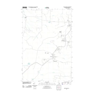
2011 Map of South Range
USGS Topo · Published 2011About this map
Atlantic Mine and Champion Mine anchor the copper country landscape in this detailed study of the Keweenaw Peninsula’s industrial backbone. The string of mining settlements—including Trimountain, Baltic, and Painesdale—follows a distinct linear development pattern established during the peak of the local mining era. Beyond the towns, the terrain is shaped by waterways such as Obenhoff Creek and Slates Creek, which flow through the forested uplands toward Twelvemile Lake and Lake Perrault. Genealogy researchers will find significant value in the documentation of the Atlantic Mine Cemetery and Mountain View Cemetery, while the placement of the South Range Post Office and Trimountain Tower provides precise landmarks for understanding the early 21st-century footprint of these historic communities.
Find a feature on this map
41 named features on this map. Tap any name to fly to it.
Don’t see what you’re looking for? This feature index may not catch every label — zoom into the map to look around manually.
Map Details
Editions of this 2011 South Range Map
This is the sole edition of this map. No revisions or reprints were ever made.
Other maps of this area

1915 · Houghton
USGS Topo · 1:62,500

1946 · Hancock
USGS Topo · 1:24,000

1946 · Chassell
USGS Topo · 1:24,000

1946 · South Range
USGS Topo · 1:24,000

1948 · South Range
USGS Topo · 1:24,000

1948 · Hancock
USGS Topo · 1:24,000

1948 · Chassell
USGS Topo · 1:24,000

1954 · Graveraet River
USGS Topo · 1:24,000

1954 · Oskar
USGS Topo · 1:24,000

1954 · Beacon Hill
USGS Topo · 1:24,000