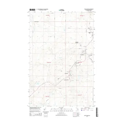
2014 Map of South Range
USGS Topo · Published 2014About this map
South Range and a string of historic mining settlements follow the elevated terrain of the Copper Country's volcanic ridges in this 2014 survey. The map documents the industrial legacy and closely spaced communities that once thrived on the Keweenaw Peninsula's mineral wealth, including Atlantic Mine, Trimountain, and Painesdale. To the north, the landscape transitions into a network of small water bodies and creeks like Obenhoff Lake and Salmon Trout River, which flow through the forested lowlands toward Lake Superior. Local history is preserved in the location of the Atlantic Mine Cem and the Mtn View Cem near Mill Mine Junction. The survey details a dense grid of residential streets in Baltic and Champion Mine, connected by State Hwy 26, providing a clear record of the area's development and its enduring relationship with the rugged topography of Tolonen Hill.
Find a feature on this map
63 named features on this map. Tap any name to fly to it.
Don’t see what you’re looking for? This feature index may not catch every label — zoom into the map to look around manually.
Map Details
Editions of this 2014 South Range Map
This is the sole edition of this map. No revisions or reprints were ever made.
Other maps of this area

1915 · Houghton
USGS Topo · 1:62,500

1946 · Hancock
USGS Topo · 1:24,000

1946 · Chassell
USGS Topo · 1:24,000

1946 · South Range
USGS Topo · 1:24,000

1948 · South Range
USGS Topo · 1:24,000

1948 · Hancock
USGS Topo · 1:24,000

1948 · Chassell
USGS Topo · 1:24,000

1954 · Graveraet River
USGS Topo · 1:24,000

1954 · Oskar
USGS Topo · 1:24,000

1954 · Beacon Hill
USGS Topo · 1:24,000