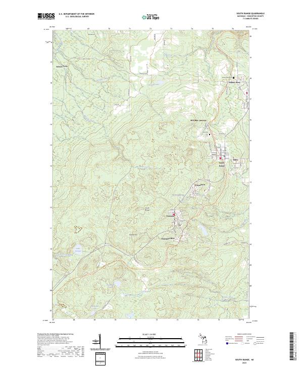
2023 Map of South Range
USGS Topo · Published 2023About this map
Atlantic Mine and Champion Mine anchor this copper-rich corridor of Michigan's Keweenaw Peninsula, where industrial heritage is etched into the landscape. The geography is defined by a series of company-born settlements including Painesdale, Trimountain, and Baltic that grew along the mining lodes. Modern infrastructure like the Bill Nicholls Route Trl now follows the historical rail paths that once connected these works. The terrain rises toward Tolonen Hill and drops away into the drainage basins of the Salmon Trout River, Pilgrim River, and Slates Creek. A network of small glacial lakes, such as Lake Perrault, Elevenmile Lake, and Twelvemile Lake, are scattered throughout the wooded surroundings. The map also documents local legacy sites for genealogists, including the Atlantic Mine Cem and Mountain View Cem near Mill Mine Junction.
Find a feature on this map
67 named features on this map. Tap any name to fly to it.
Don’t see what you’re looking for? This feature index may not catch every label — zoom into the map to look around manually.
Map Details
Editions of this 2023 South Range Map
This is the sole edition of this map. No revisions or reprints were ever made.
Other maps of this area

1915 · Houghton
USGS Topo · 1:62,500

1946 · Hancock
USGS Topo · 1:24,000

1946 · Chassell
USGS Topo · 1:24,000

1946 · South Range
USGS Topo · 1:24,000

1948 · South Range
USGS Topo · 1:24,000

1948 · Hancock
USGS Topo · 1:24,000

1948 · Chassell
USGS Topo · 1:24,000

1954 · Graveraet River
USGS Topo · 1:24,000

1954 · Oskar
USGS Topo · 1:24,000

1954 · Beacon Hill
USGS Topo · 1:24,000