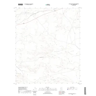
2019 Map of South Rector Canyon
USGS Topo · Published 2019About this map
Rector Canyon and its southern counterpart, South Rector Canyon, dominate this arid landscape in Culberson County, where elevation and hydrology dictate the region's sparse infrastructure. The terrain is defined by deep cuts into the limestone, including Lamar Canyon to the south and the Yeso Hills in the northeast. Water management is critical in this environment, evidenced by isolated features such as Cave Tank and Well Drill Tank, which serve as vital points in an otherwise dry network of draws. Transportation is limited to the northern edge of the sheet, where 62 180 cuts across the basin, providing the primary access point near Big Canyon. This 2019 survey illustrates the persistent ranching and topographic character of the Texas borderlands, where named draws like McKittrick Canyon Draw and Well Drill Draw channel infrequent runoff through the high desert floor.
Find a feature on this map
11 named features on this map. Tap any name to fly to it.
Don’t see what you’re looking for? This feature index may not catch every label — zoom into the map to look around manually.
Map Details
Editions of this 2019 South Rector Canyon Map
This is the sole edition of this map. No revisions or reprints were ever made.
Other maps of this area

1940 · Carlsbad Caverns West
USGS Topo · 1:62,500

1943 · Carlsbad Caverns West
USGS Topo · 1:62,500

1945 · Carlsbad Caverns East
USGS Topo · 1:62,500

1947 · Carlsbad Caverns East
USGS Topo · 1:62,500

1954 · Carlsbad
USGS Topo · 1:250,000

1954 · Van Horn
USGS Topo · 1:250,000

1958 · Van Horn
USGS Topo · 1:250,000

1958 · Carlsbad
USGS Topo · 1:250,000

1973 · Cow Mountain
USGS Topo · 1:24,000

1973 · Delaware Spring
USGS Topo · 1:24,000