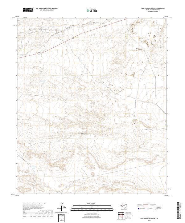
2022 Map of South Rector Canyon
USGS Topo · Published 2022About this map
South Rector Canyon and Rector Canyon dominate the drainage patterns of this arid Culberson County landscape, where the terrain transitions toward the Yeso Hills to the east. The map illustrates a remote high-desert environment defined by significant natural draws and canyons, including the prominent McKittrick Canyon Draw and Big Canyon in the northern reaches. Human presence is sparse, marked primarily by essential water management features such as Cave Tank and Well Drill Tank, reflecting the necessity of water storage in this section of the Trans-Pecos. Transportation is limited to major corridors like highway 62 180 and FM 652, which cut through the drainage systems of Well Drill Draw and Lamar Canyon, providing the only structured access across these complex geological formations.
Find a feature on this map
11 named features on this map. Tap any name to fly to it.
Don’t see what you’re looking for? This feature index may not catch every label — zoom into the map to look around manually.
Map Details
Editions of this 2022 South Rector Canyon Map
This is the sole edition of this map. No revisions or reprints were ever made.
Other maps of this area

1940 · Carlsbad Caverns West
USGS Topo · 1:62,500

1943 · Carlsbad Caverns West
USGS Topo · 1:62,500

1945 · Carlsbad Caverns East
USGS Topo · 1:62,500

1947 · Carlsbad Caverns East
USGS Topo · 1:62,500

1954 · Carlsbad
USGS Topo · 1:250,000

1954 · Van Horn
USGS Topo · 1:250,000

1958 · Van Horn
USGS Topo · 1:250,000

1958 · Carlsbad
USGS Topo · 1:250,000

1973 · Cow Mountain
USGS Topo · 1:24,000

1973 · Delaware Spring
USGS Topo · 1:24,000