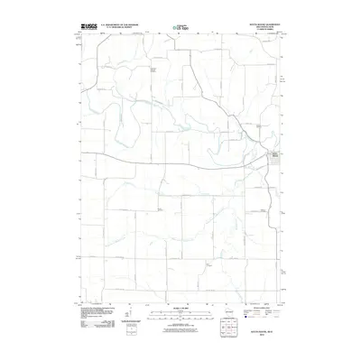
2010 Map of South Wayne
USGS Topo · Published 2010About this map
The Pecatonica River meanders across this landscape on the border of Wisconsin and Illinois, defining a region where agricultural life is anchored by family-named roads and rural burial grounds. The village of South Wayne sits near the eastern edge of the quadrangle, serving as a focal point for the surrounding farmsteads. The land is drained by a network of waterways including Turtle Creek, Spafford Creek, and the Feather Branch, all of which influence the layout of local infrastructure. Genealogists will find significant value in the distribution of several historic cemeteries, such as the West Wiota Lutheran Cemetery in the north and the Zion Cemetery further south. The map's detailed road network, featuring names like Komprood Rd, Boelk Ln, and Larse Rd, reflects a history of long-standing family landholdings and rural settlement patterns that have persisted into the 21st century.
Find a feature on this map
51 named features on this map. Tap any name to fly to it.
Don’t see what you’re looking for? This feature index may not catch every label — zoom into the map to look around manually.
Map Details
Editions of this 2010 South Wayne Map
This is the sole edition of this map. No revisions or reprints were ever made.
Other maps of this area

1902 · Mineral Point
USGS Topo · 1:125,000

1911 · Elizabeth
USGS Topo · 1:62,500

1923 · South Wayne
USGS Topo · 1:62,500

1936 · Elizabeth
USGS Topo · 1:62,500

1937 · Lena
USGS Topo · 1:48,000

1942 · Lena
USGS Topo · 1:62,500

1943 · Lena
USGS Topo · 1:62,500

1954 · Rockford
USGS Topo · 1:250,000

1955 · Rockford
USGS Topo · 1:250,000

1958 · Rockford
USGS Topo · 1:250,000