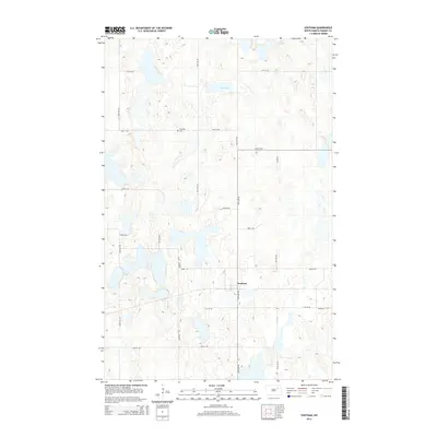
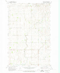
2014 Map of Southam
USGS Topo · Published 2014About this map
The settlement of Southam anchors this portion of Ramsey County, situated within a prairie landscape defined by numerous depressions and wetlands. Located along Ontario Rd, the community serves as a central point for the surrounding agricultural sections. To the northwest, Fox Lake is a prominent water body, accompanied by the nearby Fox Lake Cem, which provides a focal point for local genealogical research and family history. The terrain is crisscrossed by a structured grid of rural routes such as Co Road 6 and 57th St NE, reflecting the traditional township and range surveying system of the Great Plains. This 2014 survey documents the enduring spatial layout of these small rural outposts and the persistent natural hydrology of the North Dakota prairie.
Find a feature on this map
12 named features on this map. Tap any name to fly to it.
Don’t see what you’re looking for? This feature index may not catch every label — zoom into the map to look around manually.
Map Details
Editions of this 2014 Southam Map
This is the sole edition of this map. No revisions or reprints were ever made.
Other maps of this area

1951 · Crary
USGS Topo · 1:24,000

1953 · Devils Lake
USGS Topo · 1:250,000

1956 · Devils Lake
USGS Topo · 1:250,000
1970 · Bartlett
USGS Topo · 1:24,000

1971 · Southam
USGS Topo · 1:24,000
1971 · Crary NW
USGS Topo · 1:24,000
1971 · Doyon
USGS Topo · 1:24,000

1971 · Lakota NW
USGS Topo · 1:24,000

1972 · Derrick SE
USGS Topo · 1:24,000
1972 · Derrick SW
USGS Topo · 1:24,000