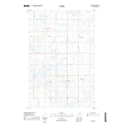
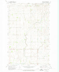
2017 Map of Southam
USGS Topo · Published 2017About this map
The small community of Southam serves as the focal point of this Ramsey County landscape, situated where Co Hwy 4 intersects with local section roads. The terrain is defined by a dense network of prairie potholes and wetlands, with Fox Lake as the most prominent water body in the northern half of the quadrangle. Genealogical interest centers on the Fox Lake Cem, located just south of the lake's shoreline along 95th Ave NE. The map reveals a highly structured grid of rural infrastructure, including Ontario Rd and 51st St NE, which divide the expansive agricultural tracts of the region. This 2017 survey reflects the enduring township and range system, specifically within t155n r62w and t154n r61w, illustrating how modern digital mapping continues to document the established settlement patterns of the North Dakota plains.
Find a feature on this map
22 named features on this map. Tap any name to fly to it.
Don’t see what you’re looking for? This feature index may not catch every label — zoom into the map to look around manually.
Map Details
Editions of this 2017 Southam Map
This is the sole edition of this map. No revisions or reprints were ever made.
Other maps of this area

1951 · Crary
USGS Topo · 1:24,000

1953 · Devils Lake
USGS Topo · 1:250,000

1956 · Devils Lake
USGS Topo · 1:250,000
1970 · Bartlett
USGS Topo · 1:24,000

1971 · Southam
USGS Topo · 1:24,000
1971 · Crary NW
USGS Topo · 1:24,000
1971 · Doyon
USGS Topo · 1:24,000

1971 · Lakota NW
USGS Topo · 1:24,000

1972 · Derrick SE
USGS Topo · 1:24,000
1972 · Derrick SW
USGS Topo · 1:24,000