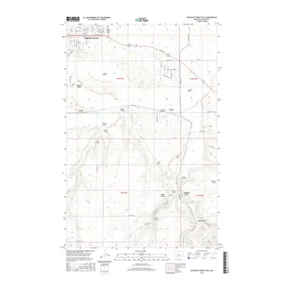
2017 Map of Southeast Great Falls
USGS Topo · Published 2017About this map
Great Falls expands south and east into a landscape defined by industrial history and deep drainage ravines. South of the city, the terrain transitions into the namesake Gibson Flats and Johnson Flats, where local heritage is marked by sites like the Hebrew Cem. The southern portion of the quadrangle is bisected by the winding path of Sand Coulee Cr, which carves through the earth near the historic coal-mining settlements of Tracy, Centerville, and the numerically named Number Seven. This network of "coulees," including Mining Coulee and Antelope Coulee, highlights the specialized geological features of the Missouri River watershed. Residential development around Ella Ave and 10th Ave S gives way to a more rural pattern of ranch roads like Goon Hill Rd and E Hunter Rd, leading toward the distinct elevation of Gobbler Knob.
Find a feature on this map
50 named features on this map. Tap any name to fly to it.
Don’t see what you’re looking for? This feature index may not catch every label — zoom into the map to look around manually.
Map Details
Editions of this 2017 Southeast Great Falls Map
This is the sole edition of this map. No revisions or reprints were ever made.
Other maps of this area

1886 · Great Falls
USGS Topo · 1:250,000

1948 · Portage
USGS Topo · 1:62,500

1949 · Portage
USGS Topo · 1:62,500

1949 · Great Falls
USGS Topo · 1:62,500

1951 · Great Falls
USGS Topo · 1:62,500

1954 · Great Falls
USGS Topo · 1:250,000

1955 · Stockett
USGS Topo · 1:62,500

1955 · Gore Hill
USGS Topo · 1:62,500

1957 · Great Falls
USGS Topo · 1:250,000

1965 · Eden
USGS Topo · 1:24,000