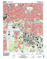
1997 Map of Southeast Memphis
USGS Topo · Published 2000About this map
Memphis's southern urban expansion is defined here by massive logistics hubs and educational campuses during the late 1990s. The sprawling Memphis International Airport dominates the west-central portion of the map, neighbored by the Tennessee Air National Guard and the extensive industrial facilities of the Defense Depot Memphis. This period shows the city's heavy reliance on rail and air transit, with the sprawling Yale Yards and Tennessee Yards facilitating freight movement across the Shelby County landscape.
Find a feature on this map
87 named features on this map. Tap any name to fly to it.
Don’t see what you’re looking for? This feature index may not catch every label — zoom into the map to look around manually.
Map Details
Editions of this 1997 Southeast Memphis Map
This is the sole edition of this map. No revisions or reprints were ever made.
Other maps of this area

1916 · Memphis
USGS Topo · 1:62,500

1925 · Memphis
USGS Topo · 1:48,000

1927 · Memphis
USGS Topo · 1:62,500

1932 · Horn Lake
USGS Topo · 1:48,000

1935 · Horn Lake
USGS Topo · 1:62,500

1939 · Memphis
USGS Topo · 1:62,500

1944 · Hernando
USGS Topo · 1:62,500

1948 · Helena
USGS Topo · 1:250,000

1950 · Helena
USGS Topo · 1:250,000

1953 · Memphis
USGS Topo · 1:250,000