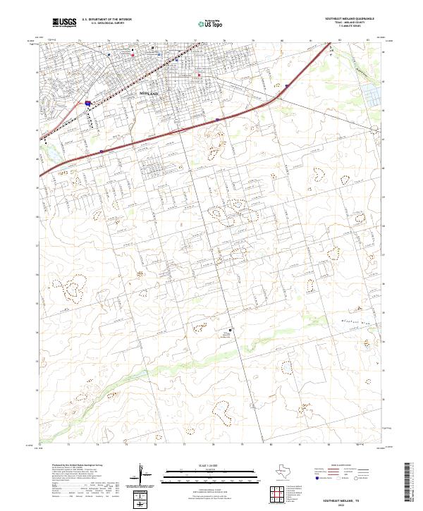
2022 Map of Southeast Midland
USGS Topo · Published 2022About this map
The expanding southern edge of Midland is defined by a dense grid of residential and commercial streets that quickly transition into the rural road networks of the Permian Basin. This modern topographic record highlights the city's residential core through thoroughfares like W Florida Ave and W Front St, while documenting specific community landmarks such as the Episcopal Church Of The Holy Trinity Columbarium and the First Presbyterian Church Columbarium.
Find a feature on this map
94 named features on this map. Tap any name to fly to it.
Don’t see what you’re looking for? This feature index may not catch every label — zoom into the map to look around manually.
Map Details
Editions of this 2022 Southeast Midland Map
This is the sole edition of this map. No revisions or reprints were ever made.
Other maps of this area

1954 · Hobbs
USGS Topo · 1:250,000

1954 · Pecos
USGS Topo · 1:250,000

1954 · Big Spring
USGS Topo · 1:250,000

1954 · San Angelo
USGS Topo · 1:250,000

1957 · Pecos
USGS Topo · 1:250,000

1958 · San Angelo
USGS Topo · 1:250,000

1958 · Big Spring
USGS Topo · 1:250,000

1958 · Hobbs
USGS Topo · 1:250,000

1964 · Bryant Ranch
USGS Topo · 1:24,000

1964 · Parks
USGS Topo · 1:24,000