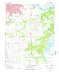
1974 Map of Southeast Muskogee
USGS Topo · Published 1978About this map
The city of Muskogee anchors the northwestern corner of this mid-1970s survey, showing its steady expansion beyond the central hub into planned residential developments like Grandview Heights. The industrial and transportation infrastructure of the era is evident at the sprawling Davis Field aviation facility and the nearby Fairground, which reflect the region's role as a regional commerce center. This survey captures a specific moment in the land-use history of Muskogee County, where suburbanization began to meet the agricultural and rural townships to the south and east.
Find a feature on this map
21 named features on this map. Tap any name to fly to it.
Don’t see what you’re looking for? This feature index may not catch every label — zoom into the map to look around manually.
Map Details
Editions of this 1974 Southeast Muskogee Map
This is the sole edition of this map. No revisions or reprints were ever made.
Other maps of this area

1901 · Muscogee
USGS Topo · 1:125,000

1905 · Muscogee
USGS Topo · 1:125,000

1946 · Fort Smith
USGS Topo · 1:250,000

1948 · Hulbert
USGS Topo · 1:62,500

1948 · Keefeton
USGS Topo · 1:62,500

1948 · Webbers Falls
USGS Topo · 1:62,500

1948 · Wagoner
USGS Topo · 1:62,500

1950 · Keefeton
USGS Topo · 1:62,500

1950 · Wagoner
USGS Topo · 1:62,500

1950 · Hulbert
USGS Topo · 1:62,500