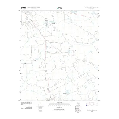
2010 Map of Southeast Palestine
USGS Topo · Published 2010About this map
Chambers Cemetery, Bell Cemetery, and several Starr family burials define the local genealogy of this rural landscape southeast of Palestine. The terrain is a network of small creeks and managed water bodies, including Calhoun Lake Number 1 and Elkhart Lake. This 2010 survey reflects a period where traditional land use, represented by numerous family cemeteries and the Camp Hill Oil Field, persists alongside modern road developments like Loop 256.
Find a feature on this map
80 named features on this map. Tap any name to fly to it.
Don’t see what you’re looking for? This feature index may not catch every label — zoom into the map to look around manually.
Map Details
Editions of this 2010 Southeast Palestine Map
This is the sole edition of this map. No revisions or reprints were ever made.
Other maps of this area

1949 · Palestine
USGS Topo · 1:62,500

1950 · Palestine
USGS Topo · 1:62,500

1951 · Elkhart
USGS Topo · 1:62,500

1951 · Jacksonville
USGS Topo · 1:62,500

1952 · Slocum
USGS Topo · 1:62,500

1953 · Palestine
USGS Topo · 1:250,000

1957 · Palestine
USGS Topo · 1:250,000

1981 · Palestine
USGS Topo · 1:100,000
1982 · Indian Lake
USGS Topo · 1:24,000
1982 · Northwest Palestine
USGS Topo · 1:24,000