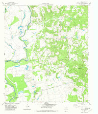
1982 Map of Indian Lake
USGS Topo · Published 1982About this map
Trinity River floodplains dominate the western edge of this landscape at the triple-junction of Anderson, Leon, and Houston counties. The river meanders past a series of oxbow lakes, including Indian Lake, Criminal Lake, Spring Lake, and the evocative Ti Ti Lake. Inland, the terrain rises into wooded hills drained by Box Creek and Manson Creek, where the rural character of the region is defined by family-named landmarks and country congregations. The small community of Redtown serves as a local hub near Tabernacle Ch, while St Andrews Ch and County Line Ch anchor other corners of the map. Genealogists will find significant detail in the placement of rural burial grounds like Parker Cem, Davis Cem, and Lee Washington Cem. This 1982 edition also reveals the region's resource extraction through numerous Gas Wells scattered across the eastern creek valleys.
Find a feature on this map
27 named features on this map. Tap any name to fly to it.
Don’t see what you’re looking for? This feature index may not catch every label — zoom into the map to look around manually.
Map Details
Editions of this 1982 Indian Lake Map
This is the sole edition of this map. No revisions or reprints were ever made.
Other maps of this area

1951 · Elkhart
USGS Topo · 1:62,500

1953 · Palestine
USGS Topo · 1:250,000

1957 · Palestine
USGS Topo · 1:250,000

1964 · Long Lake
USGS Topo · 1:24,000

1964 · Oakwood
USGS Topo · 1:24,000

1964 · Lake Leon
USGS Topo · 1:24,000

1964 · Hays Spring
USGS Topo · 1:24,000

1964 · Stanmire Lake
USGS Topo · 1:24,000

1981 · Palestine
USGS Topo · 1:100,000
1982 · Elkhart Creek
USGS Topo · 1:24,000