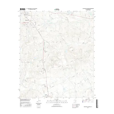
2016 Map of Southeast Palestine
USGS Topo · Published 2016About this map
The town of Palestine sits at the northern edge of this East Texas survey, where the urban grid gives way to a landscape defined by creeks and numerous family-named burial grounds. This region is a vital corridor for those researching Anderson County roots, as it contains a high density of small cemeteries including Chambers Cem, Bell Cem, Campbell Cem, and the Thomas Starr Cem. The terrain rises toward Camp Hill, a prominent landmark overlooking Lake Mary and the winding course of Snake Cr. To the south, the settlement of Elkhart anchor the map near the Garden of Memories Cem, while numerous seasonal waterways like Stills Cr and Frost Cr drain the timbered hills. The transition from the residential streets of Palestine to the rural farm roads illustrates the enduring agricultural and residential patterns of the area.
Find a feature on this map
55 named features on this map. Tap any name to fly to it.
Don’t see what you’re looking for? This feature index may not catch every label — zoom into the map to look around manually.
Map Details
Editions of this 2016 Southeast Palestine Map
This is the sole edition of this map. No revisions or reprints were ever made.
Other maps of this area

1949 · Palestine
USGS Topo · 1:62,500

1950 · Palestine
USGS Topo · 1:62,500

1951 · Elkhart
USGS Topo · 1:62,500

1951 · Jacksonville
USGS Topo · 1:62,500

1952 · Slocum
USGS Topo · 1:62,500

1953 · Palestine
USGS Topo · 1:250,000

1957 · Palestine
USGS Topo · 1:250,000

1981 · Palestine
USGS Topo · 1:100,000
1982 · Indian Lake
USGS Topo · 1:24,000
1982 · Northwest Palestine
USGS Topo · 1:24,000