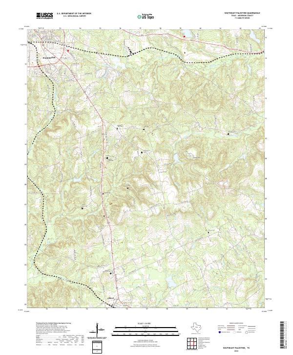
2022 Map of Southeast Palestine
USGS Topo · Published 2022About this map
Palestine and Elkhart anchor this landscape in Anderson County, where the transition from municipal centers to rural acreage is marked by a dense network of family and community burial grounds. This territory is heavily dissected by small waterways, including Stills Cr, Snake Cr, and Munson Cr, which have shaped the local topography and placement of rural roads. The concentration of historical markers, such as the Campbell Family Cem and Chambers - Day Cem, suggests a deeply rooted local genealogy tied to the land between these two settlements.
Find a feature on this map
104 named features on this map. Tap any name to fly to it.
Don’t see what you’re looking for? This feature index may not catch every label — zoom into the map to look around manually.
Map Details
Editions of this 2022 Southeast Palestine Map
This is the sole edition of this map. No revisions or reprints were ever made.
Other maps of this area

1949 · Palestine
USGS Topo · 1:62,500

1950 · Palestine
USGS Topo · 1:62,500

1951 · Elkhart
USGS Topo · 1:62,500

1951 · Jacksonville
USGS Topo · 1:62,500

1952 · Slocum
USGS Topo · 1:62,500

1953 · Palestine
USGS Topo · 1:250,000

1957 · Palestine
USGS Topo · 1:250,000

1981 · Palestine
USGS Topo · 1:100,000
1982 · Indian Lake
USGS Topo · 1:24,000
1982 · Northwest Palestine
USGS Topo · 1:24,000