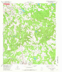
1982 Map of Southeast Palestine
USGS Topo · Published 1982About this map
Palestine serves as the northern anchor for this pocket of Anderson County, where the industrial infrastructure of the Missouri Pacific Railroad and the Texas State Railroad meets a landscape defined by small-scale oil extraction and agriculture. The southeastern corner is dominated by the Camp Hill Oil Field, a dense network of drill holes and wells that illustrate the energy production central to the local economy in the early 1980s.
Find a feature on this map
49 named features on this map. Tap any name to fly to it.
Don’t see what you’re looking for? This feature index may not catch every label — zoom into the map to look around manually.
Map Details
Editions of this 1982 Southeast Palestine Map
This is the sole edition of this map. No revisions or reprints were ever made.
Other maps of this area

1949 · Palestine
USGS Topo · 1:62,500

1950 · Palestine
USGS Topo · 1:62,500

1951 · Elkhart
USGS Topo · 1:62,500

1951 · Jacksonville
USGS Topo · 1:62,500

1952 · Slocum
USGS Topo · 1:62,500

1953 · Palestine
USGS Topo · 1:250,000

1957 · Palestine
USGS Topo · 1:250,000

1981 · Palestine
USGS Topo · 1:100,000
1982 · Indian Lake
USGS Topo · 1:24,000
1982 · Northwest Palestine
USGS Topo · 1:24,000