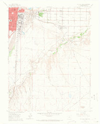
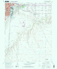
1960 Map of Southeast Pueblo
USGS Topo · Published 1966About this map
Pueblo’s industrial and residential expansion is captured here during the mid-1960s, showing a landscape defined by the convergence of major rail lines and water management systems. The dense grid of the Bessemer neighborhood, anchored by Bessemer Sch and St Mary Corwin Hospital, contrasts with the outlying residential pockets of Blende and Lombard Village. Water distribution, vital for both agriculture and the growing city, is visible through the Bessemer Ditch and Edson Ditch as they navigate the breaks near the St Charles River. This era shows a community in transition, balancing established institutions like the Boys Home and Roselawn Cemetery with the emerging suburban sprawl along Santa Fe Drive. The map also traces the extensive rail infrastructure of the Denver and Rio Grande Western and the Colorado and Wyoming railroads, which serviced the region's industrial core.
Find a feature on this map
39 named features on this map. Tap any name to fly to it.
Don’t see what you’re looking for? This feature index may not catch every label — zoom into the map to look around manually.
Map Details
Editions of this 1960 Southeast Pueblo Map
6 editions found

Other maps of this area

1891 · Pueblo
USGS Topo · 1:125,000

1891 · Nepesta
USGS Topo · 1:125,000

1893 · Nepesta
USGS Topo · 1:125,000

1894 · Pueblo
USGS Topo · 1:125,000

1896 · Pueblo
USGS Topo · 1:125,000

1897 · Pueblo
USGS Topo · 1:125,000

1904 · Nepesta
USGS Topo · 1:125,000

1954 · Pueblo
USGS Topo · 1:250,000

1957 · Pueblo
USGS Topo · 1:250,000

1958 · Pueblo
USGS Topo · 1:250,000