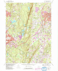
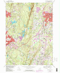
1968 Map of Southington
USGS Topo · Published 1992About this map
Southington Mountain divides this Connecticut landscape, separating the residential growth of Southington and Plantsville from the reservoir-dotted uplands to the west. This mid-century record captures a period of significant suburban expansion, evidenced by the cluster of modern schools like Kennedy Jr High Sch and the development of the I-84 corridor through Marion and Milldale. Deeply rooted history remains visible in the numerous burial sites, from the Northwest Burying Ground to the Olde Burying Ground near the Quinnipiac River. In the southern portion, the State Reformatory stands as a significant landmark in Cheshire, while the western hills around Wolcott are defined by water management features like the Scovill Reservoir and Hitchcock Lake. This survey illustrates the transition from a traditional New England manufacturing and farming valley into a modern residential hub connected by a newly built interstate system.
Find a feature on this map
80 named features on this map. Tap any name to fly to it.
Don’t see what you’re looking for? This feature index may not catch every label — zoom into the map to look around manually.
Map Details
Editions of this 1968 Southington Map
5 editions found
Other maps of this area

1889 · Derby
USGS Topo · 1:62,500

1891 · Derby
USGS Topo · 1:62,500

1892 · New Haven
USGS Topo · 1:62,500

1892 · Meriden
USGS Topo · 1:62,500

1893 · Waterbury
USGS Topo · 1:62,500

1893 · Meriden
USGS Topo · 1:62,500

1893 · Derby
USGS Topo · 1:62,500

1904 · Waterbury
USGS Topo · 1:62,500

1904 · Litchfield
USGS Topo · 1:125,000

1906 · Farmington
USGS Topo · 1:125,000