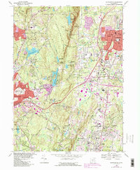
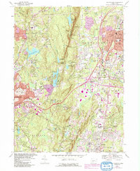
1968 Map of Southington
USGS Topo · Published 1992About this map
Southington Mountain dominates the central topography of this 1968 study, serving as a prominent north-south ridge that separates the suburban expansion of Southington from the residential clusters in Wolcott. The landscape is a complex mix of mid-century industrial utility and preservation, featuring several municipal water sources such as Southington Reservoir No 1 and the New Britain Reservoir. Along the eastern corridor, the Conrail line and the newly developed interstate interchanges near Plantsville and Milldale signal the area's transition into a modern commuter and logistics hub. Genealogy and local history researchers will find significant detail in the numerous burial sites, including the Olde Burying Ground and Northeast Burying Ground, alongside institutional landmarks like the State Reformatory in Cheshire. The map also captures vanished social landmarks of the era, such as the Drive-in Theater located near the Quinnipiac River.
Find a feature on this map
92 named features on this map. Tap any name to fly to it.
Don’t see what you’re looking for? This feature index may not catch every label — zoom into the map to look around manually.
Map Details
Editions of this 1968 Southington Map
5 editions found
Other maps of this area

1889 · Derby
USGS Topo · 1:62,500

1891 · Derby
USGS Topo · 1:62,500

1892 · New Haven
USGS Topo · 1:62,500

1892 · Meriden
USGS Topo · 1:62,500

1893 · Waterbury
USGS Topo · 1:62,500

1893 · Meriden
USGS Topo · 1:62,500

1893 · Derby
USGS Topo · 1:62,500

1904 · Waterbury
USGS Topo · 1:62,500

1904 · Litchfield
USGS Topo · 1:125,000

1906 · Farmington
USGS Topo · 1:125,000