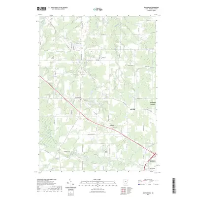
2023 Map of Southington
USGS Topo · Published 2023About this map
The crossroads of Southington and Delightful serve as the primary anchors for this rural Trumbull County landscape, where agricultural fields are deeply carved by the Grand River and its numerous tributaries. These waterways, including Dead Branch, Tinker Creek, and Eagle Creek, create a complex network of wetlands and drainage basins like Long Swamp and Beaver Pond. The map reveals a high concentration of small family and community burial grounds, such as Baptist Hill Cem, Maltby Cem, and Reform Cem, which offer significant data points for genealogists tracing early settlement patterns.
Find a feature on this map
78 named features on this map. Tap any name to fly to it.
Don’t see what you’re looking for? This feature index may not catch every label — zoom into the map to look around manually.
Map Details
Editions of this 2023 Southington Map
This is the sole edition of this map. No revisions or reprints were ever made.
Other maps of this area

1905 · Bristolville
USGS Topo · 1:62,500

1905 · Garrettsville
USGS Topo · 1:62,500

1906 · Ravenna
USGS Topo · 1:62,500

1907 · Bristolville
USGS Topo · 1:62,500

1907 · Garrettsville
USGS Topo · 1:62,500

1908 · Warren
USGS Topo · 1:62,500

1908 · Ravenna
USGS Topo · 1:62,500

1950 · Cleveland
USGS Topo · 1:250,000

1952 · West Farmington
USGS Topo · 1:24,000

1952 · Southington
USGS Topo · 1:24,000
Featured Places
- Warren, OH
- Champion Township, OH
- Warren Township, OH
- Southington Township, OH
- Southington, Southington Township