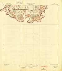
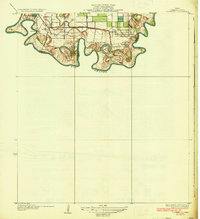
1936 Map of Southmost
USGS Topo · Published 1945About this map
Large agricultural tracts and river bends define this southernmost tip of Texas along the Rio Grande border. Several named plantations, including Piper Plantation, Rabb Plantation, and Brulay Plantation, line the fertile river bottoms, illustrating the land-use patterns of Cameron County in the 1930s. The landscape is marked by unique river features like La Canasta Banco No. 34 and Longoreno Banco No. 32, which reflect the shifting nature of the international boundary between the United States and Mexico.
Find a feature on this map
21 named features on this map. Tap any name to fly to it.
Don’t see what you’re looking for? This feature index may not catch every label — zoom into the map to look around manually.
Map Details
Editions of this 1936 Southmost Map
3 editions found
Other maps of this area

1929 · Palmito Hill
USGS Topo · 1:24,000

1930 · West Brownsville
USGS Topo · 1:24,000

1930 · East Brownsville
USGS Topo · 1:24,000
1936 · West Brownsville
USGS Topo · 1:31,680

1936 · Palmito Hill
USGS Topo · 1:31,680
1936 · East Brownsville
USGS Topo · 1:31,680
1936 · Southmost
USGS Topo · 1:31,680

1953 · Brownsville
USGS Topo · 1:250,000
1955 · Palmito Hill
USGS Topo · 1:24,000
1955 · Southmost
USGS Topo · 1:24,000