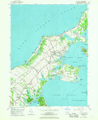
1956 Map of Southold
USGS Topo · Published 1970About this map
Southold and the surrounding North Fork hamlets are captured here at mid-century, defined by a landscape of small inlets, agricultural lanes, and the steady presence of the Long Island Railroad. The village centers of Peconic and Cutchogue are well-established, with local life anchored by institutions like the Peconic Sch and Sacred Heart Ch. Along the shoreline, the transition from maritime utility to residential development is evident in neighborhoods like Beixedon Estates and Reydon Shores, while the Horton Pt lighthouse stands as a landmark on the bluffs overlooking Long Island Sound.
Find a feature on this map
98 named features on this map. Tap any name to fly to it.
Don’t see what you’re looking for? This feature index may not catch every label — zoom into the map to look around manually.
Map Details
Editions of this 1956 Southold Map
3 editions found
Other maps of this area

1903 · Sag Harbor
USGS Topo · 1:62,500

1903 · Riverhead
USGS Topo · 1:62,500

1904 · Sag Harbor
USGS Topo · 1:62,500

1904 · Shelter Island
USGS Topo · 1:62,500

1904 · Riverhead
USGS Topo · 1:62,500

1943 · Riverhead
USGS Topo · 1:62,500

1946 · Sag Harbor
USGS Topo · 1:24,000
1947 · Orient
USGS Topo · 1:24,000

1947 · Mattituck
USGS Topo · 1:24,000

1947 · Mattituck Hills
USGS Topo · 1:24,000