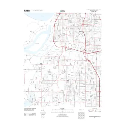
2013 Map of Southwest Memphis
USGS Topo · Published 2013About this map
Mississippi River industrial corridors and well-established neighborhoods define this portion of Shelby County, where the city’s rail and river legacy remains prominent. The northern landscape is anchored by massive transit hubs like South Yards and East Junction, while residential pockets such as Shadowlawn, Mallory, and Bunker Hill fill the spaces between major thoroughfares. To the west, the river creates a complex of waterways including Lake McKellar, Riverside Bayou, and the landform known as Treasure Island. Moving south, the map details the suburban expansion toward Whitehaven and Pisgah Heights, bisected by numerous drainage systems like Nonconnah Cr and Cypress Cr. This survey illustrates the dense integration of heavy industry, rail infrastructure, and mid-century residential planning characteristic of the region’s growth toward the Mississippi border.
Find a feature on this map
64 named features on this map. Tap any name to fly to it.
Don’t see what you’re looking for? This feature index may not catch every label — zoom into the map to look around manually.
Map Details
Editions of this 2013 Southwest Memphis Map
This is the sole edition of this map. No revisions or reprints were ever made.
Other maps of this area

1908 · Lake Cormorant
USGS Topo · 1:24,000

1912 · Lake Cormorant
USGS Topo · 1:31,680

1916 · Memphis
USGS Topo · 1:62,500

1925 · Memphis
USGS Topo · 1:48,000

1927 · Memphis
USGS Topo · 1:62,500

1932 · Horn Lake
USGS Topo · 1:48,000

1935 · Horn Lake
USGS Topo · 1:62,500

1939 · Memphis
USGS Topo · 1:62,500

1944 · Hernando
USGS Topo · 1:62,500

1948 · Helena
USGS Topo · 1:250,000