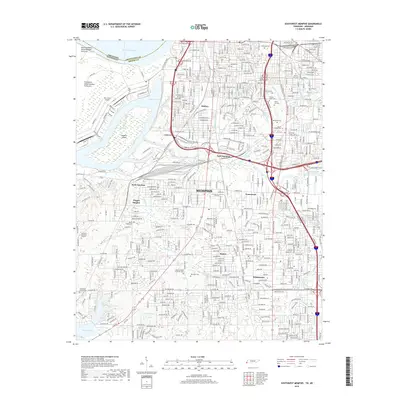
2019 Map of Southwest Memphis
USGS Topo · Published 2019About this map
Lake McKellar and the industrial corridors of South Memphis define this modern landscape, where the waters of the Mississippi River separate Tennessee from Arkansas. The area is densely packed with history-rich burial grounds, including the expansive Elmwood Cem, Calvary Cem, and Baron Hirsch Cem, reflecting the city's complex genealogical record. The industrial heart of the region is visible through labels like Mallory and West Junction, while the presence of the Isle-A-Port Airport on Presidents Island Number Forty-five highlights the logistical importance of the riverfront. Moving south into Whitehaven, the grid gives way to suburban developments and landmarks like Southland Mall, set against natural drainage features such as Nonconnah Creek and Cypress Cr. This 2019 survey documents the transition from heavy industrial waterfronts and rail hubs at East Junction to established residential communities.
Find a feature on this map
199 named features on this map. Tap any name to fly to it.
Don’t see what you’re looking for? This feature index may not catch every label — zoom into the map to look around manually.
Map Details
Editions of this 2019 Southwest Memphis Map
This is the sole edition of this map. No revisions or reprints were ever made.
Other maps of this area

1908 · Lake Cormorant
USGS Topo · 1:24,000

1912 · Lake Cormorant
USGS Topo · 1:31,680

1916 · Memphis
USGS Topo · 1:62,500

1925 · Memphis
USGS Topo · 1:48,000

1927 · Memphis
USGS Topo · 1:62,500

1932 · Horn Lake
USGS Topo · 1:48,000

1935 · Horn Lake
USGS Topo · 1:62,500

1939 · Memphis
USGS Topo · 1:62,500

1944 · Hernando
USGS Topo · 1:62,500

1948 · Helena
USGS Topo · 1:250,000