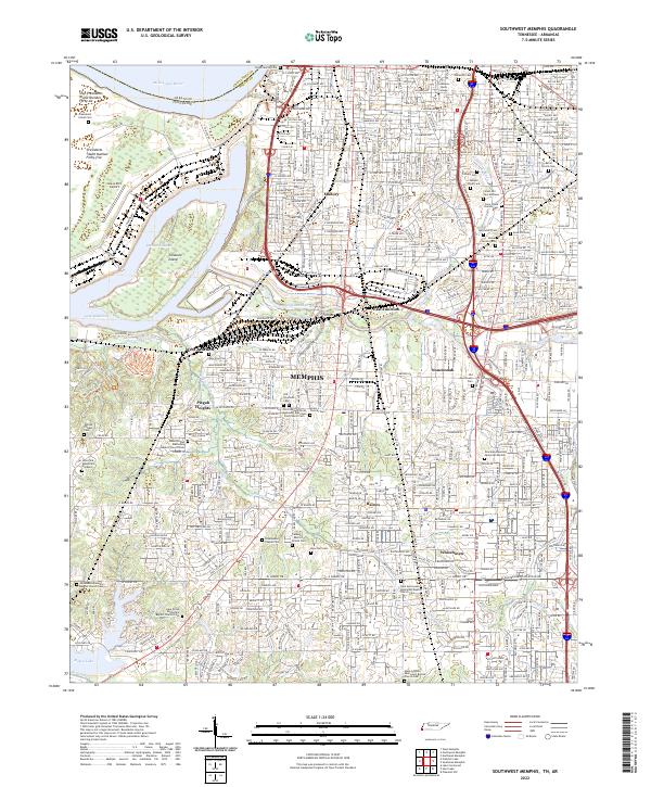
2022 Map of Southwest Memphis
USGS Topo · Published 2022About this map
The Mississippi River and its shifting channels anchor this 2022 survey of southern Memphis, where industrial riverfronts meet historic residential districts and sprawling memorial grounds. The western edge is dominated by President's Island and Vice Presidents Island Number Forty-six, separated from the city by the Harbor Channel and Lake McKellar. This landscape reveals a dense network of memory and faith, containing numerous significant burial sites including the sprawling Elmwood Cem, Calvary Cem, and Temple Israel Cem. South of the urban core, the terrain transitions into the neighborhoods of Whitehaven and Pisgah Heights, bisected by the watercourse of Nonconnah Creek. The map provides specific location data for educational and cultural institutions like LeMoyne - Owen College and the world-famous Graceland Mansion Memorial Garden, reflecting the area's deep roots in the music and civil rights history of the Mid-South.
Find a feature on this map
80 named features on this map. Tap any name to fly to it.
Don’t see what you’re looking for? This feature index may not catch every label — zoom into the map to look around manually.
Map Details
Editions of this 2022 Southwest Memphis Map
This is the sole edition of this map. No revisions or reprints were ever made.
Other maps of this area

1908 · Lake Cormorant
USGS Topo · 1:24,000

1912 · Lake Cormorant
USGS Topo · 1:31,680

1916 · Memphis
USGS Topo · 1:62,500

1925 · Memphis
USGS Topo · 1:48,000

1927 · Memphis
USGS Topo · 1:62,500

1932 · Horn Lake
USGS Topo · 1:48,000

1935 · Horn Lake
USGS Topo · 1:62,500

1939 · Memphis
USGS Topo · 1:62,500

1944 · Hernando
USGS Topo · 1:62,500

1948 · Helena
USGS Topo · 1:250,000