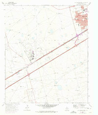
1965 Map of Southwest Midland
USGS Topo · Published 1975About this map
The Midland Regional Air Terminal serves as a central hub in this 1965 survey, documenting the city's westward expansion and infrastructure during a period of significant growth. The landscape is a study in industrial and residential development, with the Texas and Pacific railroad corridor and several aqueduct and pipeline routes cutting across the West Texas plains. The map details a well-established educational and community network within Midland, featuring schools like Anson Jones Sch and Henderson Sch, alongside neighborhood gathering places such as St Paul Ch.
Find a feature on this map
58 named features on this map. Tap any name to fly to it.
Don’t see what you’re looking for? This feature index may not catch every label — zoom into the map to look around manually.
Map Details
Editions of this 1965 Southwest Midland Map
2 editions found
Other maps of this area

1954 · Hobbs
USGS Topo · 1:250,000

1954 · Pecos
USGS Topo · 1:250,000

1957 · Pecos
USGS Topo · 1:250,000

1958 · Hobbs
USGS Topo · 1:250,000

1964 · Bryant Ranch
USGS Topo · 1:24,000

1964 · Odessa NE
USGS Topo · 1:24,000

1964 · Odessa SE
USGS Topo · 1:24,000

1964 · Parks
USGS Topo · 1:24,000

1965 · Southeast Midland
USGS Topo · 1:24,000

1965 · Southwest Midland
USGS Topo · 1:24,000