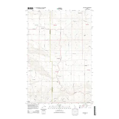
2013 Map of Southwick
USGS Topo · Published 2013About this map
Potlatch Ridge and Norwegian Ridge define the elevated topography north of the Clearwater River in this section of northern Idaho. Small settlements and rural hubs such as Southwick, Cavendish, and Teakean are connected by a network of local roads including Southwick Rd and Cavendish Rd, which navigate the deep drainages of Bedrock Cr and Louse Cr. The border between Nez Perce County and Clearwater County runs through the center of this landscape, marking a transition between the high agricultural plateaus and the canyon lands. At the southern edge, the terrain drops sharply toward the river, where the small settlement of Big George and landmarks like Snells Island sit near the water's edge. This map provides a detailed view of the community infrastructure of the early 2010s, including the Sunnyside Cem and the United Brethren Camp, set against a backdrop of steep ridges and canyons.
Find a feature on this map
62 named features on this map. Tap any name to fly to it.
Don’t see what you’re looking for? This feature index may not catch every label — zoom into the map to look around manually.
Map Details
Editions of this 2013 Southwick Map
This is the sole edition of this map. No revisions or reprints were ever made.
Other maps of this area

1924 · Kamiah
USGS Topo · 1:125,000

1955 · Pullman
USGS Topo · 1:250,000

1958 · Pullman
USGS Topo · 1:250,000

1958 · Culdesac
USGS Topo · 1:62,500

1961 · Kendrick
USGS Topo · 1:62,500

1961 · Ahsahka
USGS Topo · 1:62,500

1967 · Peck
USGS Topo · 1:24,000

1967 · Orofino West
USGS Topo · 1:24,000

1981 · Orofino
USGS Topo · 1:100,000

1981 · Potlatch
USGS Topo · 1:100,000