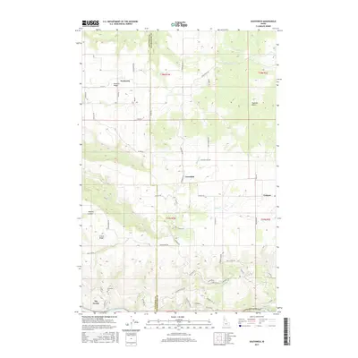
2017 Map of Southwick
USGS Topo · Published 2017About this map
Potlatch Ridge and Teakean Butte dominate the landscape of the northern Nez Perce and western Clearwater county line, marking a region of high plateaus and deep drainages. Small settlements like Southwick, Cavendish, and Teakean are connected by a network of local roads such as Cavendish Hwy and Cream Ridge Rd, reflecting a rural economy built on the terrain's natural contours. The southern edge of the map is defined by the Clearwater River, where the elevation drops significantly from the surrounding heights of Cream Ridge and Big George. Local history is anchored by sites like Sunnyside Cem, which sits near the steep descent toward the river valley. The intricate creek systems, including Bedrock Cr and Louse Cr, have carved significant features like Wheeler Canyon, illustrating the geological forces that shaped this corner of Idaho.
Find a feature on this map
59 named features on this map. Tap any name to fly to it.
Don’t see what you’re looking for? This feature index may not catch every label — zoom into the map to look around manually.
Map Details
Editions of this 2017 Southwick Map
This is the sole edition of this map. No revisions or reprints were ever made.
Other maps of this area

1924 · Kamiah
USGS Topo · 1:125,000

1955 · Pullman
USGS Topo · 1:250,000

1958 · Pullman
USGS Topo · 1:250,000

1958 · Culdesac
USGS Topo · 1:62,500

1961 · Kendrick
USGS Topo · 1:62,500

1961 · Ahsahka
USGS Topo · 1:62,500

1967 · Peck
USGS Topo · 1:24,000

1967 · Orofino West
USGS Topo · 1:24,000

1981 · Orofino
USGS Topo · 1:100,000

1981 · Potlatch
USGS Topo · 1:100,000