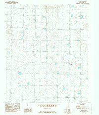
1985 Map of Spade
USGS Topo · Published 1985About this map
Spade sits at the heart of this High Plains landscape in Lamb County, centered within a vast network of agricultural resources during the mid-1980s. The settlement's layout and surrounding lands reflect the intensive irrigation practices of the Llano Estacado, indicated by the repetitive presence of Well sites that dot nearly every section of the survey. A prominent Pipeline cuts across the western portion of the terrain, moving essential resources through this productive corner of the Texas Panhandle. The topography is defined by subtle depressions and rises, such as 3566at and 3543at, which illustrate the gentle but significant drainage patterns characteristic of the region's playa-rich environment. This survey captures a specific moment in the evolution of West Texas agribusiness, documenting the exact placement of local infrastructure and water access points vital to the community's survival.
Find a feature on this map
25 named features on this map. Tap any name to fly to it.
Don’t see what you’re looking for? This feature index may not catch every label — zoom into the map to look around manually.
Map Details
Editions of this 1985 Spade Map
This is the sole edition of this map. No revisions or reprints were ever made.
Other maps of this area

1954 · Clovis
USGS Topo · 1:250,000

1954 · Brownfield
USGS Topo · 1:250,000

1957 · Anton
USGS Topo · 1:62,500

1958 · Brownfield
USGS Topo · 1:250,000

1958 · Clovis
USGS Topo · 1:250,000

1962 · Brownfield
USGS Topo · 1:250,000

1962 · Cofferville
USGS Topo · 1:24,000

1962 · Fieldton
USGS Topo · 1:24,000

1964 · Littlefield
USGS Topo · 1:24,000

1964 · Lums Chapel
USGS Topo · 1:24,000