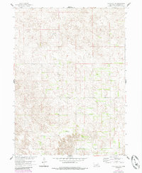
1960 Map of Spalding 2 SW
USGS Topo · Published 1985About this map
Wheeler County ranchlands and sandhills topography characterize this portion of the Nebraska landscape as surveyed in 1960. The map reveals a sparse pattern of human settlement typical of the Missouri River Basin development era, where the land is primarily organized by the township and range system near the boundary of T. 22 N. and T. 21 N.. Local education and community life are anchored by the presence of rural schoolhouses, specifically School No 20 in the eastern section and School No 24 further south. These landmarks serve as critical points of reference in an otherwise undulating terrain defined by complex contouring and limited woodland cover, which was later updated via 1981 aerial photography to reflect shifting vegetation patterns.
Find a feature on this map
6 named features on this map. Tap any name to fly to it.
Don’t see what you’re looking for? This feature index may not catch every label — zoom into the map to look around manually.
Map Details
Editions of this 1960 Spalding 2 SW Map
3 editions found
Other maps of this area

1954 · Greeley NE
USGS Topo · 1:24,000

1954 · Spalding
USGS Topo · 1:24,000

1954 · Spalding NW
USGS Topo · 1:24,000

1954 · Bartlett SE
USGS Topo · 1:24,000

1954 · Bartlett
USGS Topo · 1:24,000

1955 · Broken Bow
USGS Topo · 1:250,000

1956 · Broken Bow
USGS Topo · 1:250,000

1960 · Spalding 2 SW
USGS Topo · 1:24,000

1960 · Spalding 2 NW
USGS Topo · 1:24,000

1960 · Spalding 2 NE
USGS Topo · 1:24,000