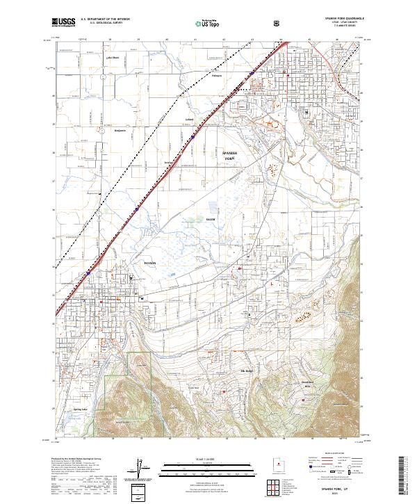
2023 Map of Spanish Fork
USGS Topo · Published 2023About this map
Spanish Fork and Payson anchor this detailed study of the Utah Valley, where the alluvial plain meets the rising peaks of the Wasatch Range. The landscape is defined by an intricate network of irrigation and water management, featuring the Strawberry Highline Canal, Salem Canal, and Mill Race Canal that support the surrounding agricultural settlements. Smaller communities such as Palmyra, Benjamin, and Leland are clearly mapped alongside significant civic landmarks like the Utah County Court House - Spanish Fork District Court. To the south, the terrain transitions into the protected lands of the Uinta National Forest, where prominent peaks such as Mollies Nipple and Tithing Mtn overlook the valley. Researchers can also identify several local burial grounds, including the Spanish Fork City Cem and Payson City Cem, which provide essential geographic context for family history in this part of Utah County.
Find a feature on this map
72 named features on this map. Tap any name to fly to it.
Don’t see what you’re looking for? This feature index may not catch every label — zoom into the map to look around manually.
Map Details
Editions of this 2023 Spanish Fork Map
This is the sole edition of this map. No revisions or reprints were ever made.
Other maps of this area

1885 · Salt Lake
USGS Topo · 1:250,000

1885 · Manti
USGS Topo · 1:250,000

1895 · Manti
USGS Topo · 1:250,000

1948 · Spanish Fork
USGS Topo · 1:24,000

1948 · Springville
USGS Topo · 1:24,000

1948 · Provo
USGS Topo · 1:24,000

1949 · Provo
USGS Topo · 1:62,500

1949 · Spanish Fork Peak
USGS Topo · 1:24,000

1950 · Provo
USGS Topo · 1:24,000
1950 · Springville
USGS Topo · 1:24,000