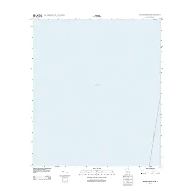
2012 Map of Spanish Fort NE OE W
USGS Topo · Published 2012About this map
Lake Pontchartrain dominates this 2012 maritime survey, providing a precise look at the waters of Jefferson Parish. The primary man-made feature is the Lake Pontchartrain Causeway, which skirts the eastern edge of the quadrangle as it spans the basin. This survey is part of the modern US Topo series, utilizing high-resolution imagery and hydrography data to map the open water and transportation infrastructure of the Louisiana coast in the early 21st century.
Find a feature on this map
2 named features on this map. Tap any name to fly to it.
Don’t see what you’re looking for? This feature index may not catch every label — zoom into the map to look around manually.
Map Details
Editions of this 2012 Spanish Fort NE OE W Map
This is the sole edition of this map. No revisions or reprints were ever made.
Other maps of this area

1891 · Spanish Fort
USGS Topo · 1:62,500

1892 · Bonnet Carre
USGS Topo · 1:62,500

1935 · Covington
USGS Topo · 1:62,500

1935 · Ponchatoula
USGS Topo · 1:62,500

1936 · Bonnet Carre
USGS Topo · 1:62,500

1936 · Spanish Fort
USGS Topo · 1:62,500
1938 · Spanish Fort
USGS Topo · 1:31,680
1938 · La Branche
USGS Topo · 1:31,680
1938 · Indian Beach
USGS Topo · 1:31,680

1939 · Ponchatoula
USGS Topo · 1:62,500
Featured Places
- Jefferson Parish, LA
- St. Tammany Parish, LA
- Tangipahoa Parish, LA
- St. John the Baptist Parish, LA
- United States