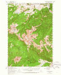
1950 Map of Spanish Peaks
USGS Topo · Published 1965About this map
The Madison Range and the high alpine terrain of the Spanish Peaks dominate this 1950 survey, showcasing a landscape defined by deep glaciated basins and prominent summits. Within the Gallatin National Forest, the map identifies early institutional and private outposts such as the Spanish Creek Ranger Station and the Rockhaven Presbyterian Camp. Settlement is sparse, limited to significant agricultural and recreational holdings like the Spanish Creek Ranch, BK Ranch, and Crail Ranch located along the valley floors.
Find a feature on this map
77 named features on this map. Tap any name to fly to it.
Don’t see what you’re looking for? This feature index may not catch every label — zoom into the map to look around manually.
Map Details
Editions of this 1950 Spanish Peaks Map
4 editions found
Other maps of this area

1888 · Three Forks
USGS Topo · 1:250,000

1894 · Three Forks
USGS Topo · 1:250,000

1895 · Three Forks
USGS Topo · 1:250,000

1947 · Bozeman
USGS Topo · 1:250,000

1948 · Bozeman
USGS Topo · 1:250,000

1949 · Anceney
USGS Topo · 1:62,500

1949 · Ennis
USGS Topo · 1:62,500

1949 · Norris
USGS Topo · 1:62,500

1950 · Cameron
USGS Topo · 1:62,500

1950 · Spanish Peaks
USGS Topo · 1:62,500
Featured Places
- Big Sky, MT
- Big Sky Mountain Village, MT
- Big Sky Canyon Village, MT
- Big Sky Meadow Village, MT
- Beacon Point, MT