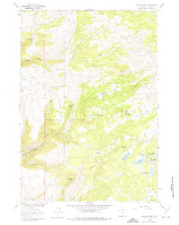
1960 Map of Spanish Point
USGS Topo · Published 1974About this map
Bighorn National Forest defines this high-elevation landscape, where the headwaters of numerous mountain creeks descend toward the Bighorn Basin. In the early 1960s, the area served as a critical nexus for range management and outdoor recreation, evidenced by the presence of the Paint Rock Guard Station and the Paint Rock Lodge. The map documents a complex network of pack trails and early motor paths, including the Edelman Trail and a Jeep Trail winding through the steep terrain of Trapper Canyon. A significant cluster of alpine lakes, such as Upper and Lower Medicine Lodge Lake, highlights the importance of the local watershed. Notable landmarks like Spanish Point and Black Butte rise above the drainage systems of Dry Medicine Lodge Creek and Trout Creek, while isolated sites like Taylor Cow Camp point to the enduring tradition of high-country cattle grazing in this portion of Big Horn County.
Find a feature on this map
30 named features on this map. Tap any name to fly to it.
Don’t see what you’re looking for? This feature index may not catch every label — zoom into the map to look around manually.
Map Details
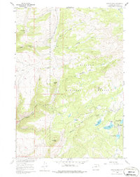
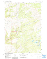
Editions of this 1960 Spanish Point Map
4 editions found

Other maps of this area

1895 · Dayton
USGS Topo · 1:125,000

1898 · Bald Mountain
USGS Topo · 1:125,000

1899 · Cloud peak
USGS Topo · 1:125,000

1901 · Cloud Peak
USGS Topo · 1:125,000

1901 · Dayton
USGS Topo · 1:125,000

1901 · Bald Mountain
USGS Topo · 1:125,000

1955 · Sheridan
USGS Topo · 1:250,000

1958 · Sheridan
USGS Topo · 1:250,000

1960 · Shell Falls
USGS Topo · 1:24,000

1960 · Shell Lake
USGS Topo · 1:24,000