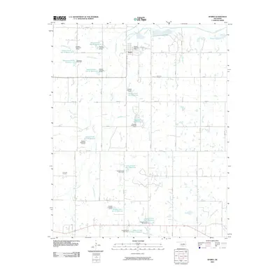
2009 Map of Sparks
USGS Topo · Published 2009About this map
The town of Sparks serves as the central hub for this Lincoln County landscape, situated along the northern section of the map near Broadway Ave. This area is defined by a dense network of water management features, including a series of reservoirs such as the Quapaw Creek Site 43 Reservoir and Oknoname 08103 Reservoir. These man-made impoundments and their associated dams, like the Quapaw Creek Site 1 Dam, illustrate a significant effort to manage the local hydrology of Quapaw Creek and its many tributaries.
Find a feature on this map
52 named features on this map. Tap any name to fly to it.
Don’t see what you’re looking for? This feature index may not catch every label — zoom into the map to look around manually.
Map Details
Editions of this 2009 Sparks Map
This is the sole edition of this map. No revisions or reprints were ever made.
Other maps of this area

1896 · Seminole and Prague
USGS Topo · 1:125,000

1905 · Chandler
USGS Topo · 1:62,500

1907 · Chandler
USGS Topo · 1:62,500

1909 · Shawnee
USGS Topo · 1:62,500

1929 · Stroud
USGS Topo · 1:62,500

1932 · Stroud
USGS Topo · 1:62,500

1954 · Oklahoma City
USGS Topo · 1:250,000

1957 · Oklahoma City
USGS Topo · 1:250,000

1963 · Oklahoma City
USGS Topo · 1:250,000
1967 · Aydelotte
USGS Topo · 1:24,000