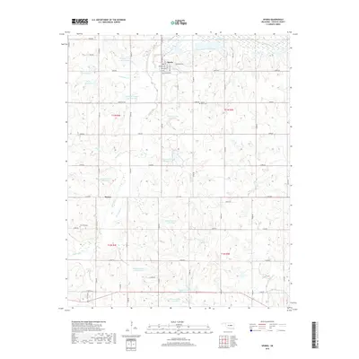
2018 Map of Sparks
USGS Topo · Published 2018About this map
The town of Sparks sits at the intersection of a grid-iron street plan and the rural section lines of Lincoln County. This landscape is defined by the extensive watershed management of the Deep Fork and its tributaries, characterized by a series of numbered flood control structures such as Quapaw Cr Site 44 Reservoir and Quapaw Cr Site 5c Reservoir. These reservoirs, scattered across the drainage basins of Hogshooter Cr and Quapaw Cr, illustrate a modern engineered approach to the Oklahoma terrain.
Find a feature on this map
60 named features on this map. Tap any name to fly to it.
Don’t see what you’re looking for? This feature index may not catch every label — zoom into the map to look around manually.
Map Details
Editions of this 2018 Sparks Map
This is the sole edition of this map. No revisions or reprints were ever made.
Other maps of this area

1896 · Seminole and Prague
USGS Topo · 1:125,000

1905 · Chandler
USGS Topo · 1:62,500

1907 · Chandler
USGS Topo · 1:62,500

1909 · Shawnee
USGS Topo · 1:62,500

1929 · Stroud
USGS Topo · 1:62,500

1932 · Stroud
USGS Topo · 1:62,500

1954 · Oklahoma City
USGS Topo · 1:250,000

1957 · Oklahoma City
USGS Topo · 1:250,000

1963 · Oklahoma City
USGS Topo · 1:250,000
1967 · Aydelotte
USGS Topo · 1:24,000