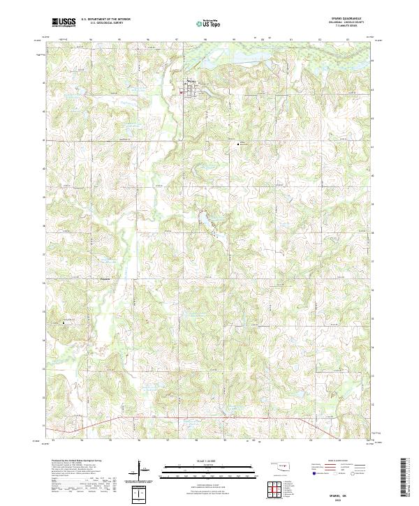
2022 Map of Sparks
USGS Topo · Published 2022About this map
The town of Sparks serves as the central hub of this Lincoln County landscape, situated where the grid of Broadway Ave and McLaughlin Ave meets the surrounding rural section lines. The terrain is defined by a sophisticated system of flood control and water management, evidenced by numerous numbered impoundments such as Quapaw Cr Site 44 Reservoir and Quapaw Cr Site 2 Reservoir. These man-made features interact with a dense network of natural drainage, including Hogshooter Cr, Breakfast Cr, and Little Sand Cr, all eventually contributing to the Deep Fork river system in the north. Genealogists will find interest in localized burial sites like White Dove Cem and Sunnyside Cem, which anchor the community's history amidst the rolling Oklahoma plains. The map illustrates a contemporary balance between small-town infrastructure and the persistent agricultural and hydrological patterns of the region.
Find a feature on this map
52 named features on this map. Tap any name to fly to it.
Don’t see what you’re looking for? This feature index may not catch every label — zoom into the map to look around manually.
Map Details
Editions of this 2022 Sparks Map
This is the sole edition of this map. No revisions or reprints were ever made.
Other maps of this area

1896 · Seminole and Prague
USGS Topo · 1:125,000

1905 · Chandler
USGS Topo · 1:62,500

1907 · Chandler
USGS Topo · 1:62,500

1909 · Shawnee
USGS Topo · 1:62,500

1929 · Stroud
USGS Topo · 1:62,500

1932 · Stroud
USGS Topo · 1:62,500

1954 · Oklahoma City
USGS Topo · 1:250,000

1957 · Oklahoma City
USGS Topo · 1:250,000

1963 · Oklahoma City
USGS Topo · 1:250,000
1967 · Aydelotte
USGS Topo · 1:24,000