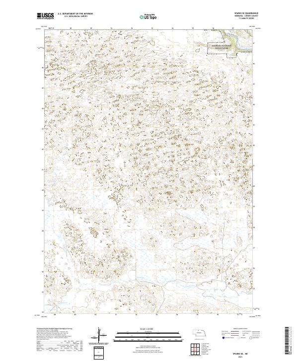
2021 Map of Sparks SE
USGS Topo · Published 2021About this map
The Niobrara River carves through the northern reaches of this Cherry County landscape, a corridor protected as both the Niobrara National Scenic River and the Niobrara Wild and Scenic River. This survey captures the characteristic topography of north-central Nebraska, where dramatic drainage patterns are formed by southern tributaries. Moving across the high plains terrain, the waters of Fairfield Cr and Lost Cr flow toward the primary river valley, defining the local hydrology. This 2021 update illustrates the modern configuration of these protected federal lands and the surrounding sections of the Public Land Survey System, providing a detailed record of the waterways and terrain as they existed in the early twenty-first century.
Find a feature on this map
11 named features on this map. Tap any name to fly to it.
Don’t see what you’re looking for? This feature index may not catch every label — zoom into the map to look around manually.
Map Details
Editions of this 2021 Sparks SE Map
This is the sole edition of this map. No revisions or reprints were ever made.
Other maps of this area

1950 · Norden
USGS Topo · 1:62,500

1950 · Sparks
USGS Topo · 1:62,500

1950 · Wood Lake
USGS Topo · 1:62,500

1950 · Arabia
USGS Topo · 1:62,500

1952 · Norden
USGS Topo · 1:62,500

1957 · Valentine
USGS Topo · 1:250,000

1959 · Valentine
USGS Topo · 1:250,000
1983 · Sparks
USGS Topo · 1:24,000
1983 · Muleshoe Creek
USGS Topo · 1:24,000
1983 · Thatcher
USGS Topo · 1:24,000