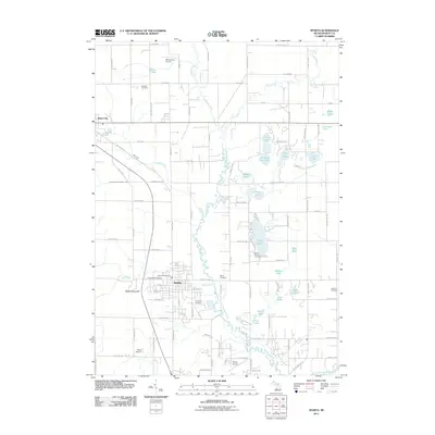
2011 Map of Sparta
USGS Topo · Published 2011About this map
The Rogue River meanders through this portion of Kent County, defining a landscape dotted with numerous glacial lakes and small aviation hubs. The village of Sparta serves as the central focal point, where the Sparta Post Office and residential streets like Ida Red Ave meet the surrounding agricultural lands. Notable for its concentration of family and community burial grounds, the area includes Greenwood Cemetery, Fairplains Cemetery, and Myers Cemetery, providing significant touchpoints for local genealogical research.
Find a feature on this map
99 named features on this map. Tap any name to fly to it.
Don’t see what you’re looking for? This feature index may not catch every label — zoom into the map to look around manually.
Map Details
Editions of this 2011 Sparta Map
This is the sole edition of this map. No revisions or reprints were ever made.
Other maps of this area

1918 · Cedar Springs
USGS Topo · 1:62,500

1943 · Cedar Springs
USGS Topo · 1:62,500

1945 · Ravenna
USGS Topo · 1:62,500

1954 · Midland
USGS Topo · 1:250,000

1958 · Midland
USGS Topo · 1:250,000

1958 · Sand Lake
USGS Topo · 1:62,500

1958 · Fremont
USGS Topo · 1:62,500

1959 · Midland
USGS Topo · 1:250,000

1966 · Midland
USGS Topo · 1:250,000

1967 · Sparta
USGS Topo · 1:24,000