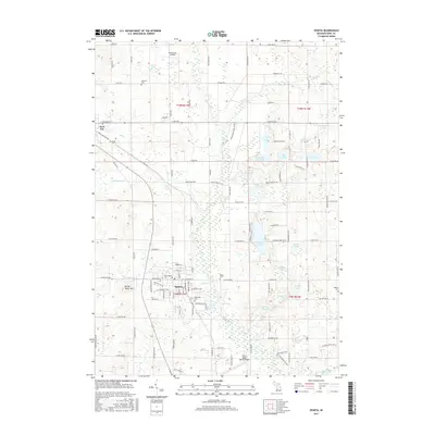
2017 Map of Sparta
USGS Topo · Published 2017About this map
The Rogue River meanders through this portion of Kent County, defining a landscape of glacial lakes and small agricultural hubs. The village of Sparta serves as the central focal point, showing a dense grid of streets including W Division St and Grove St, situated near the confluence of Nash Creek and the river. To the northwest, Kent City marks the edge of the survey, while the small settlement of Greenwood sits just outside Sparta's main cluster. This 2017 record captures the area's aviation infrastructure with both the Paul C. Miller-Sparta Airport and the smaller Wilderness Airpark.
Find a feature on this map
83 named features on this map. Tap any name to fly to it.
Don’t see what you’re looking for? This feature index may not catch every label — zoom into the map to look around manually.
Map Details
Editions of this 2017 Sparta Map
This is the sole edition of this map. No revisions or reprints were ever made.
Other maps of this area

1918 · Cedar Springs
USGS Topo · 1:62,500

1943 · Cedar Springs
USGS Topo · 1:62,500

1945 · Ravenna
USGS Topo · 1:62,500

1954 · Midland
USGS Topo · 1:250,000

1958 · Midland
USGS Topo · 1:250,000

1958 · Sand Lake
USGS Topo · 1:62,500

1958 · Fremont
USGS Topo · 1:62,500

1959 · Midland
USGS Topo · 1:250,000

1966 · Midland
USGS Topo · 1:250,000

1967 · Sparta
USGS Topo · 1:24,000