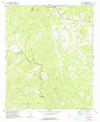
1972 Map of Sparta NE
USGS Topo · Published 1991About this map
Powelton sits on the western edge of this landscape, serving as a focal point near the intersection of several county boundaries. The terrain is defined by a dense network of tributaries feeding into the Ogeechee River and Rocky Comfort Creek, including the family-named Walker Branch and Chapman Branch. This 1972 survey, later photoinspected in the early 1980s, highlights the rural community structure of Warren, Hancock, and Taliaferro Counties through its scattered houses of worship and fire management infrastructure. Local life centers around rural landmarks like New Hope Ch, Greenwood Ch, and Rocky Branch Ch. The presence of the Barnett Lookout Tower and a large Pipeline corridor indicates the area's role in forest monitoring and regional infrastructure, while numerous unnamed cemeteries suggest deep-rooted family ties throughout the hills around Potato Hill.
Find a feature on this map
26 named features on this map. Tap any name to fly to it.
Don’t see what you’re looking for? This feature index may not catch every label — zoom into the map to look around manually.
Map Details
Editions of this 1972 Sparta NE Map
2 editions found
Other maps of this area

1906 · Crawfordville
USGS Topo · 1:125,000

1953 · Athens
USGS Topo · 1:250,000

1958 · Athens
USGS Topo · 1:250,000

1959 · Athens
USGS Topo · 1:250,000

1963 · Athens
USGS Topo · 1:250,000

1966 · Crawfordville
USGS Topo · 1:24,000

1971 · Beall Springs
USGS Topo · 1:24,000

1972 · Sharon
USGS Topo · 1:24,000

1972 · Sparta NW
USGS Topo · 1:24,000
1972 · Cadley
USGS Topo · 1:24,000