
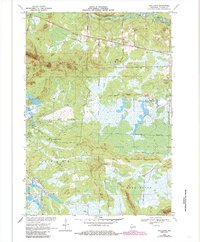
1970 Map of Spaulding
USGS Topo · Published 1972About this map
The Green Bay and Western Railroad defines the industrial transit corridor of this Jackson County landscape, passing through small rail-oriented settlements like Pray and Spaulding. This region of central Wisconsin is characterized by extensive wetlands and commercial agriculture, evident in the numerous Cranberry Bogs and the managed water systems of the North Floater Ditch and South Floater Ditch.
Find a feature on this map
33 named features on this map. Tap any name to fly to it.
Don’t see what you’re looking for? This feature index may not catch every label — zoom into the map to look around manually.
Map Details
Editions of this 1970 Spaulding Map
2 editions found
Other maps of this area

1947 · Millston
USGS Topo · 1:62,500

1949 · Millston
USGS Topo · 1:62,500

1953 · Eau Claire
USGS Topo · 1:250,000

1957 · City Point
USGS Topo · 1:48,000

1958 · Eau Claire
USGS Topo · 1:250,000

1958 · Hatfield
USGS Topo · 1:48,000

1958 · Wyeville
USGS Topo · 1:48,000

1964 · Eau Claire
USGS Topo · 1:250,000

1970 · City Point NE
USGS Topo · 1:24,000
1970 · Mather
USGS Topo · 1:24,000