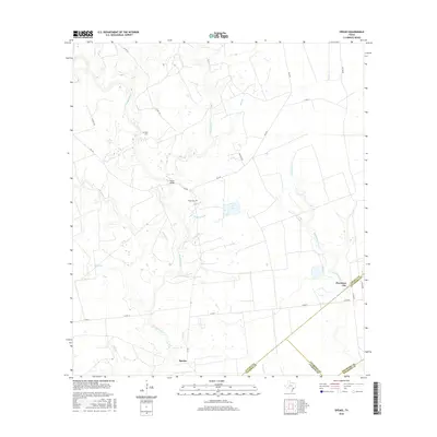
2016 Map of Speaks
USGS Topo · Published 2016About this map
The Navidad River winds through a landscape defined by its riparian corridors and early Texas cattle country heritage in this 2016 survey. Near the southern edge of the quadrangle, the community of Speaks serves as a local anchor, while the remains of Provident City sit further east near the Goldenrod Creek drainage. The map reveals a network of rural county roads and farm-to-market routes like FM 530 and FM 2437 that connect isolated homesteads and family sites.
Find a feature on this map
34 named features on this map. Tap any name to fly to it.
Don’t see what you’re looking for? This feature index may not catch every label — zoom into the map to look around manually.
Map Details
Editions of this 2016 Speaks Map
This is the sole edition of this map. No revisions or reprints were ever made.
Other maps of this area

1953 · Seguin
USGS Topo · 1:250,000

1958 · Seguin
USGS Topo · 1:250,000

1962 · Sublime
USGS Topo · 1:24,000

1962 · Hallettsville SE
USGS Topo · 1:24,000

1964 · Cordele
USGS Topo · 1:24,000

1964 · Morales
USGS Topo · 1:24,000

1964 · Speaks
USGS Topo · 1:24,000
1965 · Sheridan NE
USGS Topo · 1:24,000

1965 · Ganado NE
USGS Topo · 1:24,000

1965 · Sheridan SE
USGS Topo · 1:24,000