2021 Map of Spearfish
USGS Topo · Published 2021About this map
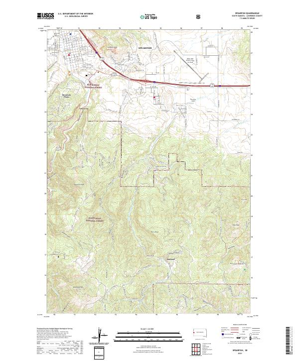
Spearfish anchors the northern edge of the Black Hills in this 2021 study, where the plains meet the rising forested topography of the Black Hills National Forest. The map documents the city's modern street grid, including W Jackson Blvd and E Colorado Blvd, while highlighting institutional landmarks like Black Hills State University and the D C Booth Historic National Fish Hatchery. Beyond the residential core, the landscape is defined by dramatic elevation changes and named drainages such as Spearfish Canyon and False Bottom Cr.
Find a feature on this map
130 named features on this map. Tap any name to fly to it.
Don’t see what you’re looking for? This feature index may not catch every label — zoom into the map to look around manually.
Map Details
Editions of this 2021 Spearfish Map
This is the sole edition of this map. No revisions or reprints were ever made.
Historical Maps of Maitland Through Time
4 maps found