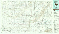
1986 Map of Spearman
USGS Topo · Published 1988About this map
Palo Duro Creek and Coldwater Creek carve deep, branching drainage patterns across this high plains landscape of the Texas Panhandle and Oklahoma border during the mid-1980s. The regional economy is anchored by an extensive oil and gas field, with the map showing a high density of industrial infrastructure supporting the energy and agricultural sectors. The city of Spearman serves as a primary hub, while smaller railroad-linked settlements like Morse, Capps Switch, and Gruver dot the grid.
Find a feature on this map
47 named features on this map. Tap any name to fly to it.
Don’t see what you’re looking for? This feature index may not catch every label — zoom into the map to look around manually.
Map Details
Editions of this 1986 Spearman Map
This is the sole edition of this map. No revisions or reprints were ever made.
Other maps of this area

1953 · Stinnett Station
USGS Topo · 1:24,000

1953 · Pringle
USGS Topo · 1:24,000

1954 · Tucumcari
USGS Topo · 1:250,000

1954 · Perryton
USGS Topo · 1:250,000

1954 · Amarillo
USGS Topo · 1:250,000

1954 · Dalhart
USGS Topo · 1:250,000

1958 · Perryton
USGS Topo · 1:250,000

1958 · Amarillo
USGS Topo · 1:250,000

1958 · Tucumcari
USGS Topo · 1:250,000

1958 · Dalhart
USGS Topo · 1:250,000