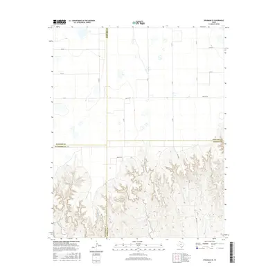
2016 Map of Spearman SE
USGS Topo · Published 2016About this map
The High Plains of the Texas Panhandle meet the eroded breaks of the Canadian River watershed in this landscape where four counties converge. The northern portion of the map is dominated by a regular grid of section roads, including Co Rd BB and Co Rd CC, serving the agricultural plateau above the caprock. This open tableland is bisected by the transition between Fm 281 and Ranch Rd 281, highlighting the rural transport network typical of the region's ranching and farming economy. To the south, the terrain transforms into a complex system of draws and canyons where drainage features like Pats Creek and Willow Cr have carved deeply into the earth. This topographical shift creates a stark boundary between the flat upland fields and the intricate canyon lands of Mathis Creek and the E Fork Pats Cr, where the county lines of Hansford, Ochiltree, Hutchinson, and Roberts meet.
Find a feature on this map
21 named features on this map. Tap any name to fly to it.
Don’t see what you’re looking for? This feature index may not catch every label — zoom into the map to look around manually.
Map Details
Editions of this 2016 Spearman SE Map
This is the sole edition of this map. No revisions or reprints were ever made.
Other maps of this area

1954 · Perryton
USGS Topo · 1:250,000

1954 · Amarillo
USGS Topo · 1:250,000

1958 · Perryton
USGS Topo · 1:250,000

1958 · Amarillo
USGS Topo · 1:250,000

1962 · Spearman
USGS Topo · 1:24,000

1971 · Dry Creek North
USGS Topo · 1:24,000

1971 · Garden Springs
USGS Topo · 1:24,000

1973 · Sourdough Creek SW
USGS Topo · 1:24,000

1973 · Spearman NE
USGS Topo · 1:24,000

1973 · Sourdough Creek NW
USGS Topo · 1:24,000