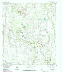
1962 Map of Speck Mountain
USGS Topo · Published 1988About this map
Speck Mountain rises as a prominent landmark in this Texas landscape, surrounded by a network of drainage features and localized petroleum activity. The area is defined by the winding course of Home Creek, which snakes through the central and southern portions of the map, eventually reaching the distinctive Horseshoe Bend. Human activity is marked by clusters of Oil Wells and several Gravel Pit operations, indicating a landscape geared toward resource extraction in the early 1960s.
Find a feature on this map
13 named features on this map. Tap any name to fly to it.
Don’t see what you’re looking for? This feature index may not catch every label — zoom into the map to look around manually.
Map Details
Editions of this 1962 Speck Mountain Map
2 editions found
Other maps of this area

1887 · Coleman
USGS Topo · 1:125,000

1889 · Coleman
USGS Topo · 1:125,000

1894 · Brady
USGS Topo · 1:125,000

1924 · Brady 2-a
USGS Topo · 1:48,000

1925 · Brady 2-b
USGS Topo · 1:48,000

1925 · Brady 1-b
USGS Topo · 1:48,000

1928 · Mercury
USGS Topo · 1:62,500

1928 · Waldrip
USGS Topo · 1:62,500

1950 · Mercury
USGS Topo · 1:62,500

1954 · Brownwood
USGS Topo · 1:250,000